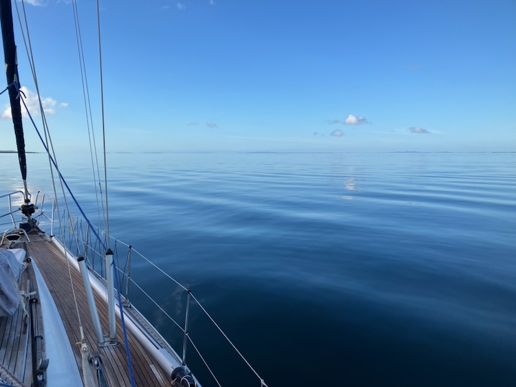
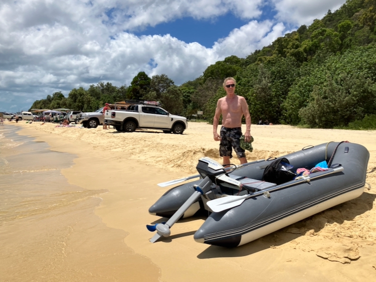
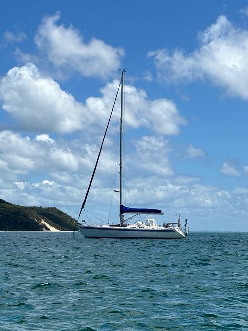
We had begun our trip down the Main Channel to the Gold Coast by anchoring at Big Sand Hill at the southern end of Moreton Island, and woke to a beautiful millpond morning.
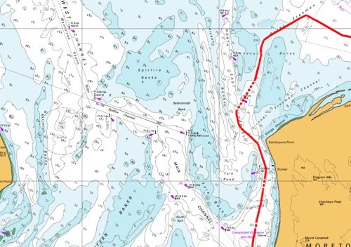
It was going to be a long day, wending our way down the tortuous curves and narrow dredged channels of the Main Channel. There is another route, the Canaipa Passage, which is said to be more picturesque, but it involves shoals and shallows that we didn’t fancy in our deep-keeled boat, so the Main Channel was our target. After an early breakfast, Berrima took us out into the bay.
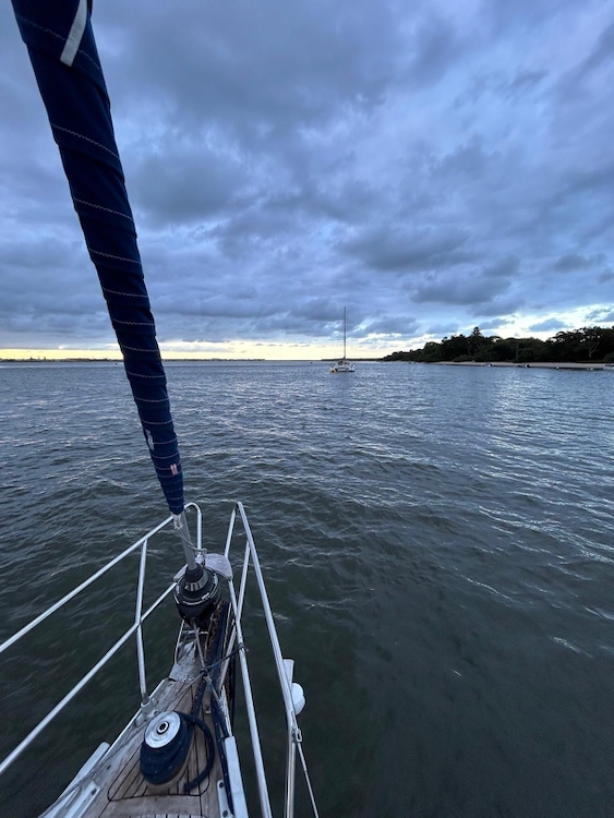
It was a beautiful day with very little wind, so we didn’t put the sails up but instead motored down Moreton Bay, from Moreton Island to North Stradbroke Island.
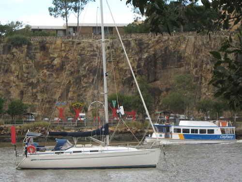
At Macleay Island, we began to thread the needle, a process that would take the remaining hours of summer daylight to complete. There were channel markers at the edges of the main sandbanks, but the paths were narrow, especially when criss-crossing with the frequent car and passenger ferries servicing Macleay Island, and we were glad to have a real-time chart display in the cockpit to guide us through the shallow parts.
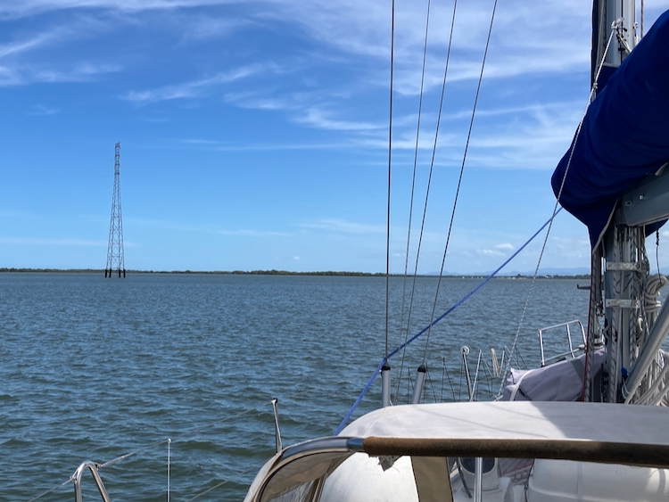
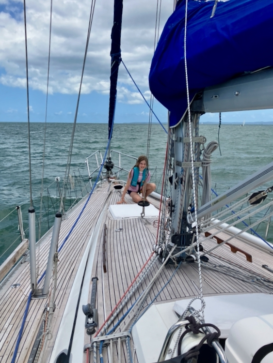
The sun burned hot as we entered the mangroves near the southern end of Russell Island, passing under an unusual pair of electricity pylons sticking up out of the river.
Threading the pylons at Russell Island
Following the markers and chasing the deeper water, we switched from side to side of the river at a steady 6 knots. We passed a German ketch which was doing a similar speed apparently under sail, but I am nowhere near a good enough sailor to try that in an unfamiliar boat.
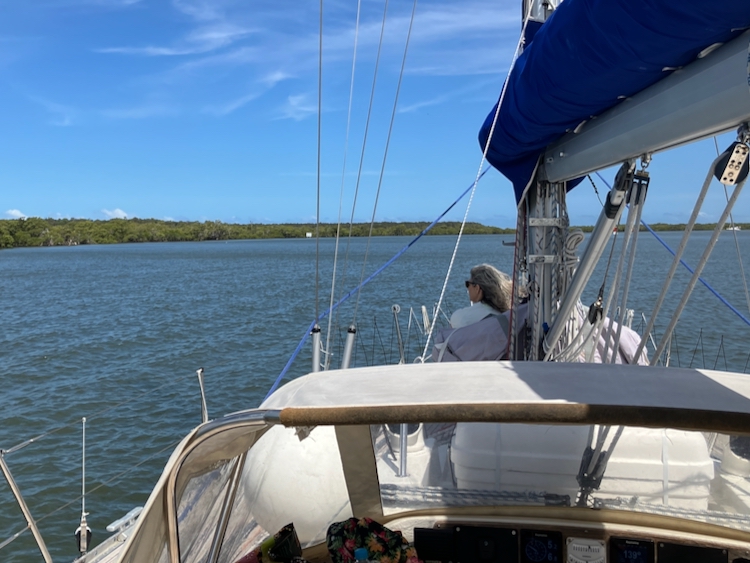
Threading the mangroves near Steiglitz
Parts of the Main Channel were crowded with houseboats, others with moored yachts. Here and there, private fishing boats scurried about. On the whole, though, it was pleasantly quiet and – if you were not at the helm nervously staring at the depth gauge – relaxing to watch the mangroves sliding gently by.
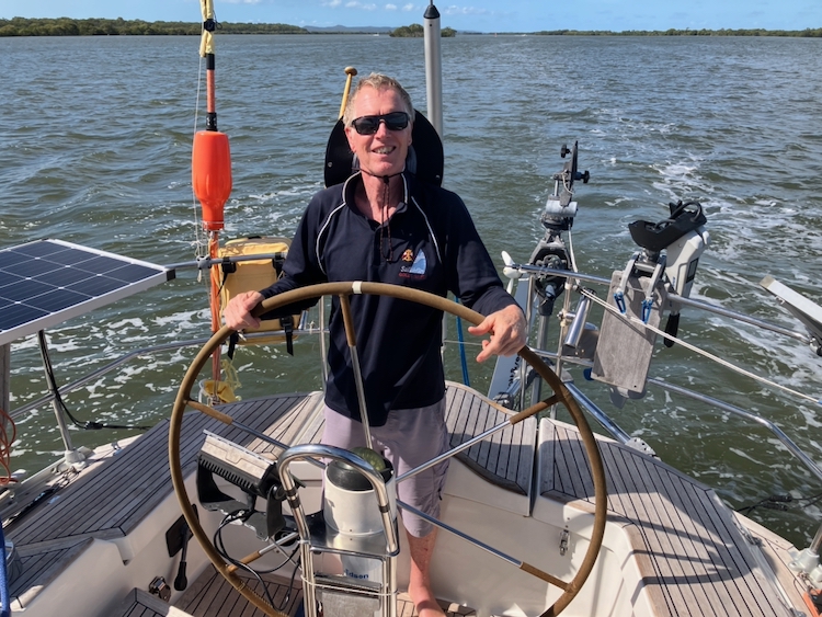
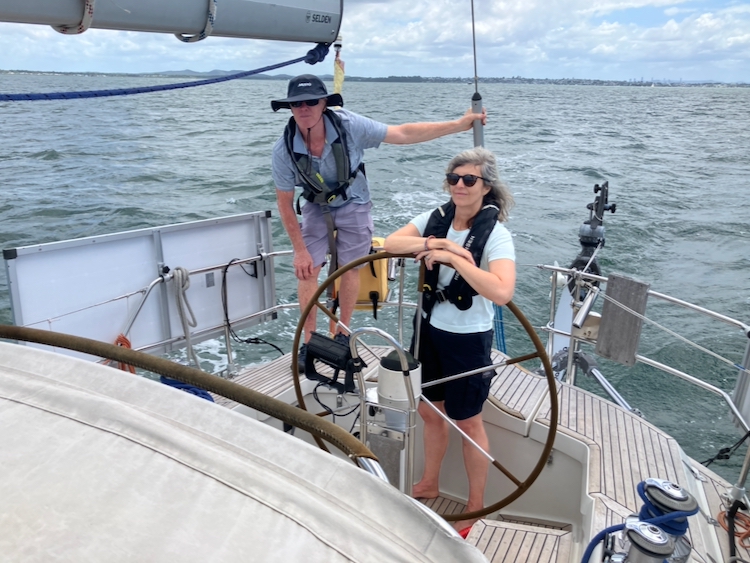
Brendon passing Never Fail Islands
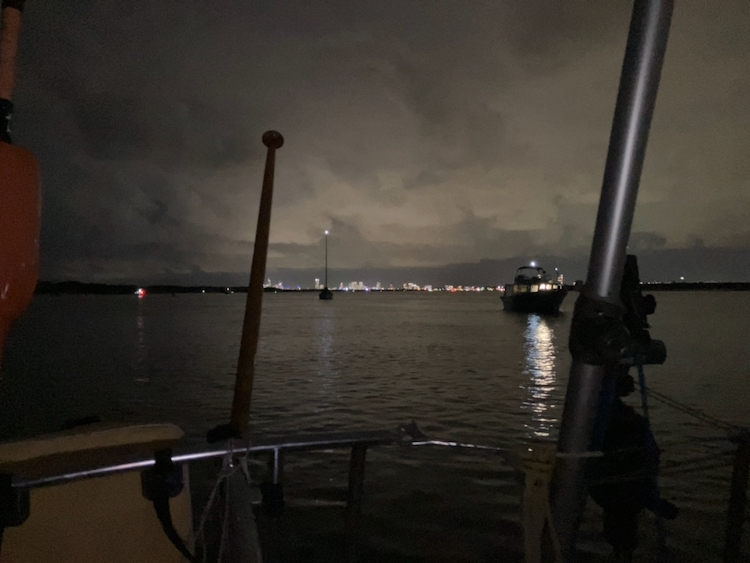
Finally, after nine hours of intense navigation, we emerged into Tipplers Passage, where Main Channel rejoins Canaipa Passage. This is at the northern end of Broadwater, which is the body of water that leads down to the Gold Coast Seaway and the flashing lights of Surfers Paradise. When we visited this area on Pindimara in 2009 we anchored close to Sea World and Surfers Paradise and it was very busy indeed, so this time we decided to stop a bit farther from the madding crowd. We dropped anchor in a well of 5-metre water off to the side of the channel in the company of a catamaran and a private trawler, and ate dinner on deck with the lights of the Gold Coast comfortably distant.
ContentAt anchorThe bright lights of Surfers Paradise
Storm clouds raced overhead. Lightning flashed in the distance. We sat in the warm breeze, serenaded by cicadas. To seaward were sheltered beaches on South Stradbroke Island, and locals drove their tinnies up to quietly sit by fires and sink a few beers before moving on for a night’s fishing.
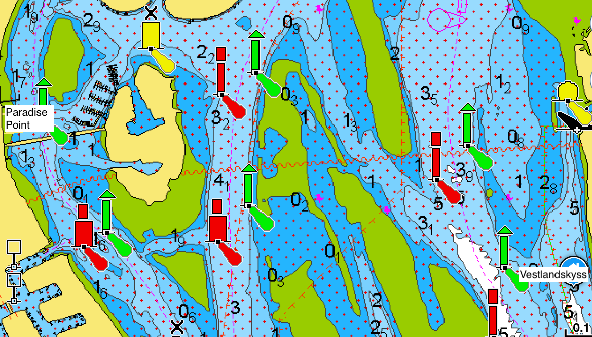
Grounding at Paradise Point
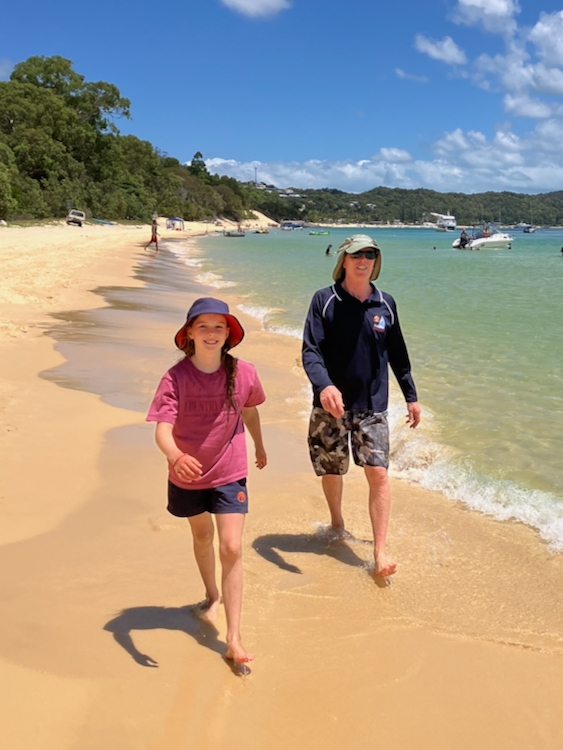
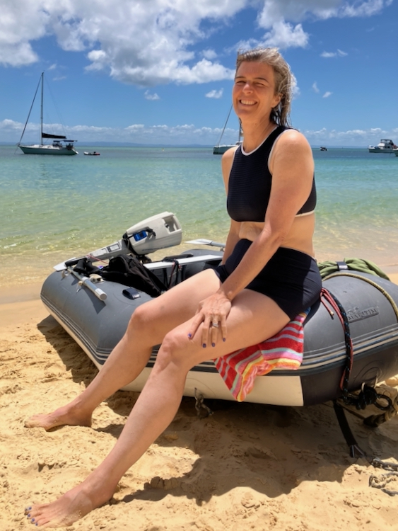
We spent most of the day at anchor in Broadwater, cleaning Vestlandskyss and getting ready for sea. There were shops about a mile across the river in Paradise Point, so Brendon, Berrima and I unrolled the electric dinghy and set off to get some provisions.
It looked like a simple river crossing, but it wasn’t. We knew about the sand bar next to us, but the tide was up and we crossed it easily. What we hadn’t expected, because we had carelessly not examined the chart, were the many weedy sand banks just below the surface as we crossed the river.
We grounded the dinghy several times, and at one point mid-channel, Brendon stepped out of the boat and waded ankle deep as he towed us to deeper water.
We finally turned into the entrance to Paradise Point marina (grounding once again), where I gave myself a scare when I saw that the indicator on the electric motor said that we had only half an hour of power left, probably not enough to carry us and our shopping back across the river to the yacht. However, a little experimentation showed that the motor was displaying a real-time estimation based on the current throttle setting, so if I backed off the power, I had well over an hour of motoring in hand.
Paradise Point had ample shops to stock up on food for the passage, though I didn’t think of dropping into the pharmacist for some seasickness tablets, which was short-sighted. We filled a load of bags with food, and made our way back to the jetty, where the local kids were using our tender as a dive platform.
We fired up the dinghy and did what we should have done in the first place, plotted a course through the shallows using the Navionics app on my phone.
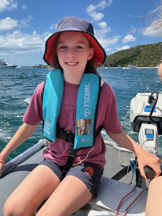
Mindful now of power drain, I drove quite slowly back across the channel, which meant that we had to keep a good lookout for fast-moving marine traffic up and down the river. Generally they were keeping watch and politely detoured around us, but we made a tempting target for one bogan on a jet-ski who split out from his pack of buddies and attempted to swamp us with a fast doughnut before accelerating off grinning. We got wet but thankfully our daughter and food were OK. Charming.
Vestlandskyss was clean, provisioned, and secured for passage. It was time to leave Main Channel and head out into the Tasman Sea.
Having now purchased a new cruising yacht, we needed to move Vestlandskyss from her existing berth in Queensland down to our home in Tasmania, over a thousand miles away. We plan to do this in stages, first down to our old stomping ground of Pittwater in New South Wales, and then across the Bass Strait as time and tide permit.
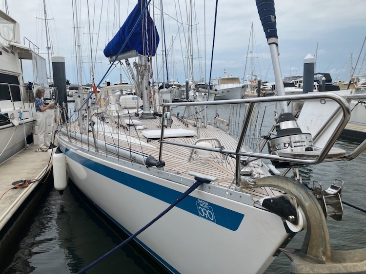
The most urgent need was to get her off her berth at the Royal Queensland Yacht Squadron, because pens there are only for the use of members. We flew up to Brisbane and were joined by our friend Brendon who had agreed to help crew for us, as we needed at least three adults to operate an overnight watch system.
Vestlandskyss at the RQYS
Preparations and Repairs
We had a lot to learn about Vestlandskyss and how she is configured, both in terms of sailing gear and technology. Thankfully, the previous owner, Ruben, had made himself available on WhatsApp and was very helpful in answering our endless questions.
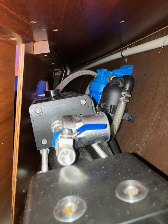
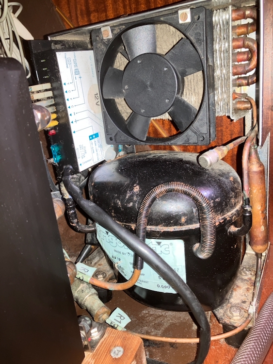
It became clear that our most obvious problems were that neither the water-maker nor the fridge were working, and we would need both of these on passage.
water-makerfridge compressor
The water-maker, a usually reliable and completely automated Schenker, would not get up to pressure. All of the documentation and troubleshooting in the manuals and online were about the opposite problem, with the pressure being too high. Reuben patiently listened to the symptoms and my thoughts, and suggested that when they had pickled the system on leaving the boat, perhaps one of the hose clamps had not been fully tightened, and some air was getting in. I tightened all of the clamps, and – behold! – we had water.
Vestlandskyss’ 26-year-old original equipment Frigomatic built-in refrigerator proved to be more difficult to fix. Ruben said that it had been working perfectly all the way across the Pacific. I could see and hear that the compressor and fan were running, but the cooling plate inside the fridge remained stubbornly at room temperature. I messed with the thermostat and cycled the power and banged the coils, but to no avail. We left it on for a few days to see if it would reach temperature, using the insulated box to store fresh fruit and vegetables in an attempt to protect them from the fierce Queensland heat. After a couple of days the compressor was running so hot that it cooked the carrots in the bottom of the fridge.
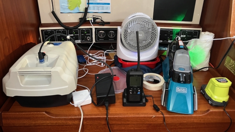
Rather than continue to fuss with it, we disconnected the Frigomatic, bought a camping fridge on sale at Anaconda, and strapped it temporarily to one of the bunks. We’ll sort out the Frigomatic unit later.
Temporary fridge strapped in
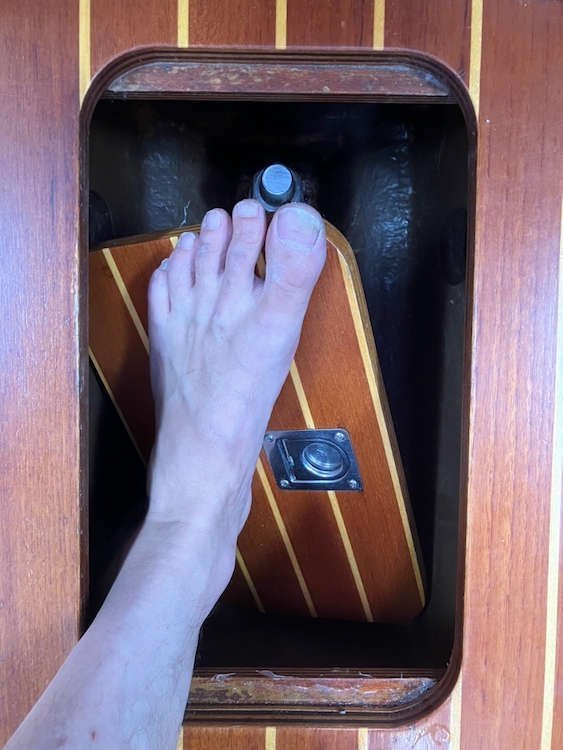
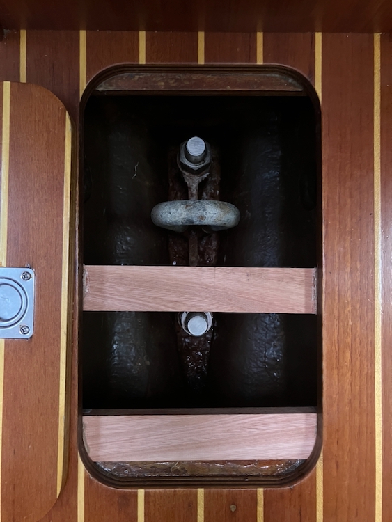
We also had a third problem to fix. When the surveyor was walking around the boat, he stepped on one of the many bilge access hatches. These floor panels are designed to be load-bearing, so even though he is quite a heavy-set man there was no reason to expect that the hatch at the bottom of the companionway would suddenly give way beneath him. Since then, we had all fallen in at different times, and had scratched ourselves up quite badly on the keel bolts beneath.
Each hatch is only supported across the short end, and in this one the stepped frame had come away from the deck. We checked around, and some of the other high-traffic hatches were showing similar signs of wear. I bought a length of Tasmanian oak and some Liquid Nails and some wood screws, and Brendon kindly lent us his new power drill, and we beefed them up a bit.
All this time, we had been watching the weather window for our first leg down to Pittwater. We were looking for three days and nights without too much bad weather, because we were keenly aware that we had never sailed this boat before and we had a child aboard who we wanted to enjoy the experience.
We waited a week for the weather to settle. In the meantime, we worked on a few more tasks.
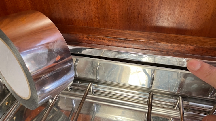
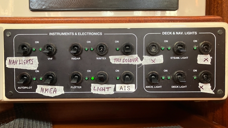
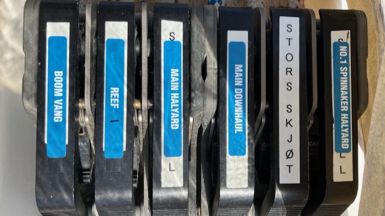
The first time that we used the relatively new gimballed stove, the varnish on the wooden side mounts began to smoke. We found some metal ducting tape at Bunnings, and heat-proofed the wood. Then I relabelled the clutches which were in Norwegian, updated the navigation software, rewired a number of instruments whose switches were broken, and charged up everything that might need charging for the voyage ahead.
It was a Saturday, and we could see a weather window opening within the next week. We had paid for our RQYS berth up until the following Friday, but we badly needed some experience sailing Vestlandskyss before venturing out to sea, so we decided to take a shakedown trip across Moreton Bay to the famed artificial reef at Tangalooma.
Sailing to Moreton Island
And we’re off! The nice couple who share our RQYS pen gave us a hand with the lines because we’re still not sure how our new yacht handles, but we backed out just fine and motored up the channel in light winds.
As we passed Green Island we hoisted the sails in 15-18 knot easterlies. The main went up easily (more easily than on the survey sail, where we found that all the reefing lines were tightly secured). We found that the main was a bit overpowered for the wind speed so we put a reef in, which was a learning exercise because we were not clear which line did what.
We had understood that Vestlandskyss had single-line reefing but this did not seem to be the case, we needed to manipulate five different lines along with the main halyard before we got it right. No doubt it will make more sense as we learn how she is set up.
We reefed the furling Genoa too, and Vestlandskyss settled into a lovely smooth 7-8 knots into the easy wind. Because this was a proving and familiarisation run, we experimented with different instrument settings, including a test of the autopilot which was very smooth indeed. We dropped in the Watt & Sea hydro generator and it seemed to be charging the batteries very well indeed. We forgot to lock the oven door, and all the metal trays spilled out as we heeled. You live and learn.
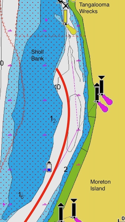
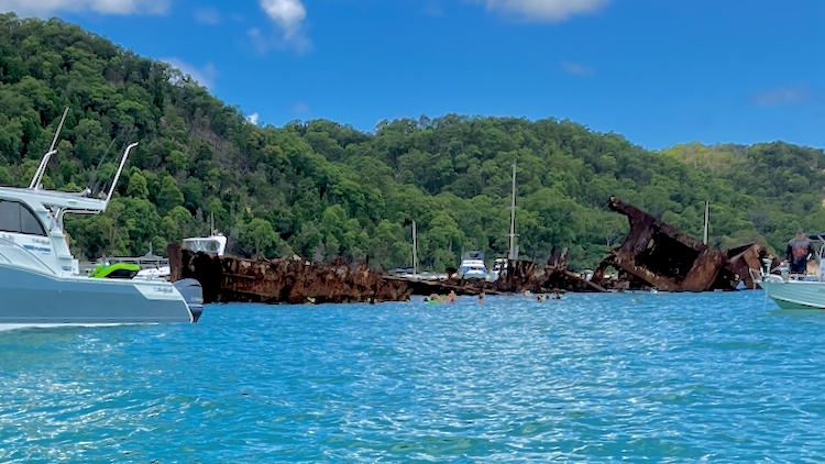
Tangalooma Reef is an attempt to make an artificial breakwater by sinking a load of old surplus ships in a line along the shore of Moreton Island. It was never very successful as a breakwater, but became very popular with snorkelers from the nearby resorts.
The reef is approached by a thin channel between the beach and the Sholl Bank sandbank, and the whole area was packed with yachts, tinnies, power boats, jet skis, resort barges, and swimmers. There was very little room to swing at anchor and we tried a few times to get our position on a narrow contour exactly right to avoid swinging into the sandbank. A couple of times the anchor chain jammed, once because it hadn’t been correctly flaked into the locker, and the next time because it got ahead of itself and several links tried to pass through the gypsy wheel at once, which took a quarter of an hour of disassembly to sort out. All of it just learning about unfamiliar equipment, and we got the job done.
We put out a mermaid line and went for a lovely swim in the warm sea, then spent some time (and more queries to the previous owner) figuring out how to turn on the deck shower. Then dinner at the cockpit table with a glass of wine, as the stars came out.
It wasn’t especially quiet, though. Tangalooma Point is a hive of activity. Jet skis buzzed past on the water, quad bikes on the land. A tourist helicopter, dolphin boats with running commentary. Then, as we put Berrima to bed, the disco started up ashore.
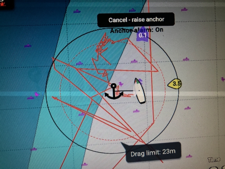
We still weren’t sure about our swing room. We turned on an anchor alarm, and a depth alarm, and a drift alarm, and went to bed. We had to set the limits very tight to be sure that we weren’t going to swing into Sholl Bank and the alarms went off with monotonous regularity all night, which had Bronwyn and Brendon up on deck checking the situation, but I didn’t hear them at all and slept on blissfully unaware. Apart from sleep deprivation, our first night at anchor was a success.
Anchor track
Tangalooma Reef
The main purpose of this part of the trip was to get used to all the equipment, so we spent much of the morning unpacking and installing and wiring up and testing the three ancillary solar panels that were usually stored under the forepeak. Between these and the permanently fixed tilting panels by the cockpit, Vestlandskyss can generate a quite astonishing 780 Watts of solar power.
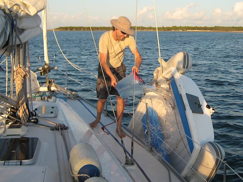
The next task was to assemble the tender, which was rolled up in a bag under the forward bunk. It has an aluminium floor in sections which have to fit together in a non-intuitive way, and the cable from the electric pump was only just long enough to reach the only compatible socket at the chart table… but with a little help from the internet, we got the thing installed and pumped up and winched into the water.
The tender has an electric motor, another first for us, and luckily I had remembered to charge it up back at the marina, so it was snorkels on and off we motored to Tangalooma Reef.
It was a bit busy. There were swimmers everywhere, mostly in large groups marshalled by guides floating in inflatable rings, and an endless criss-crossing of tenders and tinnies. We found a gap in the throng, dropped the dinghy anchor near to the wrecks, and hopped into the water.
The water was warm, but my was the current strong! We got to the jagged rusty metal of the reef, but it was a real fight to keep station, so instead of diving down on it we returned to the tender and motored to the beach.
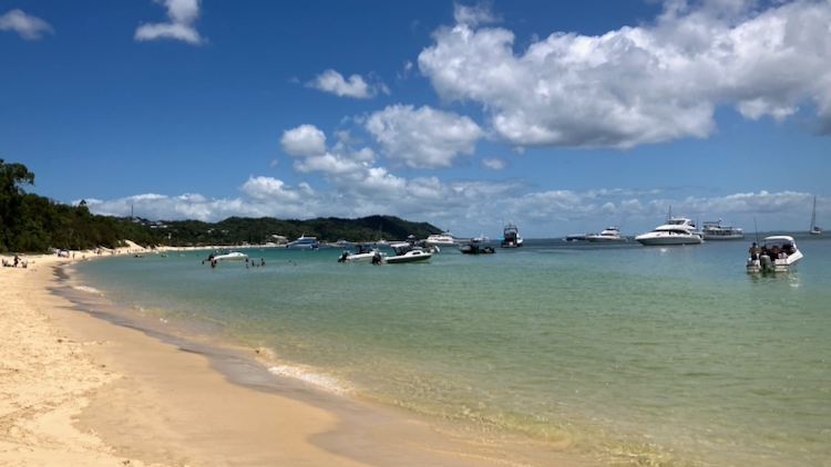
The beach was as crowded with vehicles as the sea was with boats, but the water was still and warm and a lot more enjoyable.
Finally we made our way back to Vestlandskyss, experimenting with the electric dinghy which was responsive and completely silent and very easy to drive.
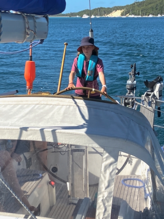
Once aboard, we disconnected all the extra solar panels, hoisted and rolled up the dinghy (securing it in its bag at the base of the mast, rather than cluttering up the forward cabin), lifted anchor and Berrima took us out of the channel.
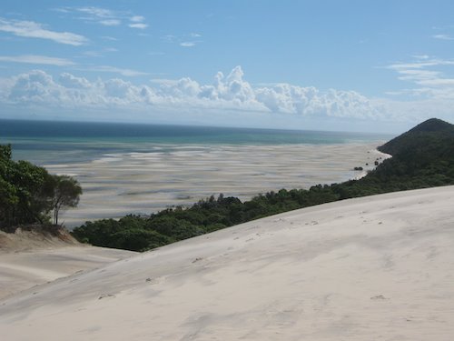
Berrima takes us outThe dunes of Moreton Island
Instead of going north around Moreton Island and crossing out to the sea that way, we had decided to head back to the south to enter the complex river system that winds and forks its way inland and down to the Gold Coast Seaway. This would give us some more experience of controlling Vestlandskyss at close quarters, and would put a few more anchorages under our belt.
The winds were fair, 9-13 knots, and we put up a reefed main and reefed genoa and got up to 6 knots before letting the foresail fully out and giving Vestlandskyss her head.
We noticed the twin dunes and clustered yachts at the southern end of Moreton Island, and as light fell we anchored in 8 metres in the wind shadow of Big Sand Hill. We had a pleasant dinner on deck under the stars, with no resort disco and perfect peace and quiet.
We’d been in two minds about going into Mooloolaba, which was the next stop before Fraser Island. We were keen to see it, but the official charts said that it was too shallow for us to reach the area marked off for anchorage, and we preferred not to pay for a marina berth. Our cruising guide stated that depths were good, but the accompanying printed chart told a different story. We knew that Pelagic had been there before so we checked with them. Not only did they say that it was plenty deep enough, but in fact they were anchored there right now, having made a fast 33-hour trip up from Iluka while we were in Brisbane.
The forecast for the next day was for very little wind, and since we wanted to arrive in Mooloolaba before sunset we worked out our passage plan for an average speed of 4 knots. This entailed a dawn start, but in the event we lazily emerged blinking into the sunlight after a long, comfortable sleep and finally hoisted the anchor at around half past eight.
Stretching before us were the hundred square miles of shoals and sand banks that had caused us so much stress on the way in. The dangers were, of course, completely invisible, lurking just below the surface of the innocently sparkling blue sea. In the pleasant sunshine, they seemed to taunt us.
Armed once more with our slightly unreliable chart, we took up the challenge. Rather than mix it with the large ships that were streaming out of the Brisbane docks and up the dredged channel, we chose to take an older, unmarked portion of the Main Channel for as long as possible, before joining them on the marked shipping route out to sea. Although requiring some more blind navigation, this had the advantage of giving us a fast beam reach in what turned out to be a rather decent southerly. Before long we were creaming along at 8 knots between the lurking sand banks and briefly considered reefing the main, but “damn the torpedoes!” we put up with a bit of weather helm because we’d probably need every inch of sail when we turned into the northerly-running shipping channel.
During the morning, we saw a number of large tankers and freighters rumbling by ahead of us, but when we actually made the final turn there was only one left in sight, and that one far ahead of us in the haze. Despite our concerns, we had the channel to ourselves for the rest of the morning.
By early afternoon, we were almost out of the clutches of Moreton Bay. Rather than follow the final couple of doglegs in the marked channel, we cut the last corner across some 6 metre deep sand banks, which made life very interesting for a while because the shallow water amplified the swell on the beam and gave us an entertaining but very rocky ride. I believe that it was at this point that the coffee thermos emptied itself over Bronwyn’s school books.
The wind was forecast to drop in the afternoon, but if anything it got a little stronger, and when we finally made it into the open sea and pointed our nose at Mooloolaba, we were running at 7-8 knots before 20-30 knots of breeze. Despite the late start, we dropped the sails and crossed the Mooloolaba bar just as the sun was setting. The bar itself presented no problems, but the school of fledgling outrigger-paddlers who straggled unheedingly across the entrance in front of us did cause us a few heart-in-mouth moments. In the end they sorted themselves out and got out of our way in good time, which was just as well because by then we were nigh-on unstoppable, lined up with the channel leads and being sucked in by the tide.
We chugged our way gently through the deepening dusk, and dropped our anchor in a few metres of water just a few boat-lengths away from Pelagic.
We were intending to head back to our old anchorage by the Sandhills dunes, but in order to get there we had to first round Mud Island, a long flat sandbank close to the Brisbane River shipping channel. As we came out of the lee of the island we got into some swell that had been building up as the wind crossed the bay from the other side.
The Sandhills anchorage is very picturesque, but it is rather exposed and does suffer rather from swell, particularly when the tide changes. Not only was Mud Island acting as a buffer for the south easterly swell, but it was also closer to the Main Channel that we would be taking in the morning, so we tucked in behind it and dropped the anchor.
The dinghy was absolutely filthy from its continual dunkings in the swamp mud at the Botanical Gardens, so I took advantage of our early stop to haul it up on a halyard and scrub it out.
CLEANING THE SWAMP OUT OF THE DINGHY
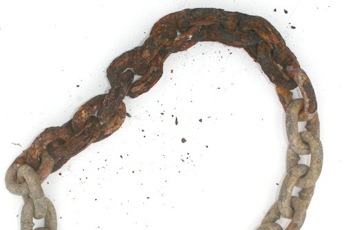
The shallow anchorage also meant that most of our chain was still in the anchor locker. I’d been waiting for a chance to work on it, so I sat on the bow and hauled it out onto the deck. Pindimara’s original chain had been marked every 5 metres by coloured spray-paint, but this had quietly eaten away the galvanisation on the chain and suddenly, one day, it rusted into a big knot and we’d had to replace the whole thing.
THE EFFECT OF SPRAY PAINT ON A GALVANISED CHAIN
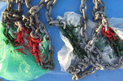
Not wanting to destroy our new chain with the same problem, we had marked the lengths with cable ties instead of spray paint, but were finding that these interfered with the smooth progress of the chain over the winch. In fact, while anchoring in the Brisbane River, the chain jumped completely off the gypsy and the whole seventy metres plummeted uncontrollably to the bottom. This was pretty alarming. Not only is there a lot of metal moving very fast alongside your feet, but the total stationary weight is about 100 kg and when it reaches the end, it can tear the D-ring right out so that you lose anchor, chain, and possibly quite a lot of hull. Only a couple of weeks previously I’d taken the precaution of adding a loop of tripled springy silver rope to the end of our chain, so all I could do was stand there and keep my toes clear and wait to see whether it would bounce or snap.
Luckily it held, but it was time to get rid of the cable ties. To this end I obtained some water-based acrylic paint, reasoning that it might not contain quite as many noxious chemicals as the spray variety. As the sun set behind and the moon rose over Mud Island in front, I sat on the fore-deck and painstakingly brushed on two coats of primer and two coats of colour, while trying very hard not to spill any paint. This started to get quite difficult when a surprise wind blew up, thrashing the boat around and splashing me with spray. I clumsily tied down the wet and sticky chain so that it wouldn’t fall over the side, and went below for dinner.
JACKSON POLLOCK, EAT YOUR HEART OUT
The sea started to get pretty sloppy. As we climbed into bed later that night, we were very glad that we were not in the open water on the other side of the bay.
It was nice to catch up with friends, but the attractions of the bright lights wore off pretty quickly. I hadn’t really noticed before, but it’s hard to buy anything useful inside a city. I needed some plumbing parts and miscellaneous chandlery. Bronwyn wanted a shower and a laundry. We found some inexpensive toilet rolls, a haircut and some discounted novels, but otherwise there was precious little of value to the visiting cruiser.
It’s been less than two months since we quit our careers and started sailing, but I was surprised to find how hard it was to relate to urban life. I was being bombarded with solutions that I didn’t need to problems that I didn’t have. Even the process of going out for a meal or a beer seemed needlessly over-complicated, and it was always a relief to return to the boat where she bobbed quietly on the edge of the swamp at the Botanical Gardens.
We’d been in Brisbane for a week, and we’d seen everybody who wanted to visit us, so it was time to move on. Unfortunately we were almost completely out of both fuel and water, and we hadn’t found anywhere where we could obtain either of those two essentials. Luckily we remembered that we’d seen a fuel bowser downriver at the city limits, so hoping that (a) it was open on Sunday, and (b) that it had drinking water, we hauled up the anchor and set off. We figured that we had enough fuel to make it that far, and if it was closed, then we’d tie up and go to sleep until it opened on Monday.
It was great to be moving again. The sun was shining and we got to see a lot of details that we’d missed on our arrival, when we’d been more concerned about lining up the leading lights in the gathering dusk. The great wool stores from the early 1900s were particularly impressive, enormous blocky brick buildings that seemed to run for miles. Presumably these used to be dockside facilities, but a great many slender modern houses have been squeezed onto what must be a new, reclaimed waterline, each with its own personal dock, although the docks were usually empty.
The fuel dock under the Gateway Bridge not only had water, but also very cheap diesel, which was quite a surprise especially when the attendant confirmed that this was now the only fuel dock left in the Brisbane area. On our travels we’ve come across dockside diesel that is almost twice the price of its roadside equivalent. I began to relax, and spent a happy half hour chatting to the attendant while Bronwyn filled the water tanks.
Fuelled and watered, we let the tide suck us down the shipping channel and out into Moreton Bay. The heat of the sun, the direction of the wind, the depth of the water, the course of the yacht ahead of us; these were important, these were reality. I felt the gritty crowded feel of the city slip away, and danced a little jig at the helm while Bronwyn rustled up some fresh home-made won-ton soup in the galley. When she brought the steaming aromatic bowls up into the cockpit, she remarked that this was the first time that she’d seen me properly smiling all week. I don’t think that she was joking.
We remained anchored in Moreton Bay for a few more days until all the weekend visitors had gone, and then hoisted our sails and headed across to the mouth of the Brisbane River. We had a nice beam reach at a consistent eight knots. Pindimara never used to go this fast. Either the boat’s changed, or we have.
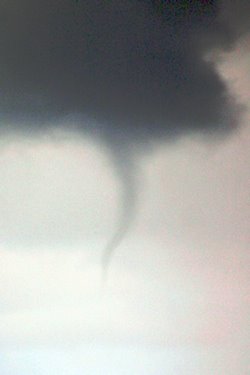
We’d been keeping half an eye on some distant rain clouds which were scudding past out to sea, and about half way across the bay we noticed a twister dropping down from the cloud base. We double-checked and it was definitely passing by outside the bay, but it was quite a fascinating sight. Neither of us had ever seen one before.
TWISTER!
We have been following the blogged exploits of another cruiser, Bob on Capricorn, who is also circumnavigating in a Bavaria but quite a few months ahead of us. In fact he had been coming up the NSW coast behind us, and when the waterspout formed, he was unlucky enough to be on the other side of Moreton Island and directly beneath it. His furler jammed and he got very wet, but luckily survived the experience without injury.
We arrived at the main Brisbane shipping channel and dropped sails for the long motor up the river to the city centre. We were sharing the relatively narrow lane with some seriously large commercial shipping, although they were travelling slowly to minimise their bow waves and some had time to wave cheerfully from the flying bridge.
Much of the first part of the Brisbane River is taken up by LPG tanker facilities, and the smell of leaking gas was pretty strong. On the other hand, there was lots to see and the depths and leading lights were uniformly excellent. Several hours later we found ourselves chugging underneath the girders of Story Bridge and into the heart of Brisbane itself.
PINDIMARA ARRIVES AT BRISBANE CBD
Many cruising guides mention the cheap pile berths by the Botanical Gardens, but we were aware of a lot of discussion in blogs and fora that suggested that they were permanently clogged with old hulks. We telephoned the Port Authority who run the pile berths, and they were quite definite that not only were the berths only for short term transient cruisers, but that there were currently a number of berths free, and gave us a list of berth numbers.
On our arrival, though, it was quite clear that not only were there no free berths, but that quite a number of boats didn’t look like they had been capable of moving for some years.
OBVIOUSLY SEAWORTHY
We dropped anchor around the bend and found good holding close to some mangroves, and when we later investigated the pile berths on foot, we found a large sign stating that the berths were available for a monthly rate, directly contradicting our Port Authority spokesperson.
It’s all worked out well because we’re very happy with our anchorage, which is only a short row from a Botanical Gardens piling where, with a little acrobatic effort at low tide, we can tie up our dinghy in safety and stroll into town, where we’ve been meeting up with various friends, and have drunk far too much expensive Belgian beer for our budget.
PINDIMARA OFF GARDEN POINT
The city’s been a bit of a shock to the system. Each morning the joggers sprint past as fast as they can with a desperate look in their eyes and headphones jacked into their ears. In the streets, everybody is hurrying around without paying any attention to anything. When we sit down in a cafe, waitresses rush up before we have a chance to get comfortable, and we find that we are infringing rules about who can sit where and when. We’re finding it all a bit manic, even Bronwyn who is a self-avowed city kid and was looking forward to some bright lights. It is strange to think that only a few short months ago we were part of this same madding crowd, but already that whole life seems impossibly remote.
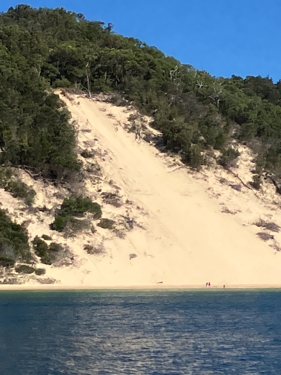
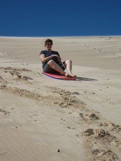
Anchored just off the ‘Sandhills’ dunes of Moreton Island, we grabbed our boogie boards and decided to try our hand at sand-surfing.
THE SCENE: KOUNUNGAI, MORETON ISLAND
After a great deal of hilarity, Bronwyn reckoned that I finally made the transition from computer geek to surfer boy, and posted this video of my biggest ride: VIDEO: SAND SURFING (3.2 Mb)
The official Hydrographic chart of Moreton Bay shows two beaconed channels that lead from the sea and through the shifting sand shoals to the bay itself. The biggest is the North West Channel, which is dredged to at least 15 metres and carries large cargo and cruise liner traffic to Brisbane. This can only be accessed from the far north of the entrance, some five hours away from our current position as we bobbed around in the rain, swell and darkness. Much closer to us was the North East Channel, and connecting us to it were two unmarked but still navigable channels known as the Inner and Outer Freeman. The Inner Freeman was far too shallow and had a notorious bar, but the Outer Freeman seemed to offer us good depths all the way across, apart from a bit at the far end where it dropped to six metres of shifting sands at either of two spurs that lead onto the North East Passage. With our 2 metre keel, this still gave us at least 4 metres of clear water even at the lowest tide.
The downside of this plan, of course, was that it was pitch dark and pouring with rain, and we were tired and had never been here before. On the other hand, our chart was only a month old and we had practised navigating with GPS at close quarters in the Solitary Islands. We really needed to get out of the swell, which was making us sick. We decided to go for it.
Navigating Pindimara by instruments requires co-ordinated teamwork and perfect trust. At the helm, Bronwyn was driving completely blind, focussed on steering a course by compass alone. This is very difficult. Usually you pick a distant object on the required bearing and aim for it, but Moreton Bay at night is a very confusing place. The shoaling area alone covers over a hundred square miles and is criss-crossed with channel markers and scattered with warning beacons both far and near, providing the helm with a shifting landscape of colour with few stable markers. Bronwyn’s only option was to stare eagle-eyed at the red glow of the compass and to try to compensate for drift and windage.
Down below, my whole world consisted of a small blinking cursor that represented our GPS position on the chart, and the shouted depth soundings from the helm. I had to judge from the cursor’s continually updated orientation and position how we were being affected by any currents or rips, and to call up course amendments as required, as well as trying to interpret Bronwyn’s depth soundings in the light of the chart contours in front of me. Every few minutes I would pop my head out of the companionway and take a compass bearing on one of the few static lighthouses as backup; electronics can fail, and charts can be wrong.
At first (after a short break when I had to run up on deck and lose my dinner over the side) it all went well, with the depth soundings corresponding well to the chart. We successfully negotiated a couple of unseen shoals, and were approaching the zone of 6 metre shifting sands. It was time to decide whether to take the relatively wide northerly passage, or the more southerly gutter. The latter was two miles long and only 500 metres wide, but would cut an hour off our journey time. It was already midnight. The currents were manageable. We headed south.
The bottom rose rapidly as the sides of the gutter closed in. Just as we passed the 6 metre contour, Bronwyn called out “four”, which was perfect because the sounder measures depth from the bottom of our 2 metre keel. I breathed a sigh of relief. The gutter was where it was supposed to be.
A following current began to push us along. Bronwyn called out “Three” and then “Two”. I stared at the chart, which showed us perfectly centred in the six-metre gutter. The sand must have shifted. We had a hasty discussion and agreed that if we came too close to bottoming out – or indeed hit – then Bronwyn would turn sharply to port and try to retrace her course, although this was going to be increasingly difficult as the current continued to sweep us along. We knew that on either side of us, invisible in the darkness, were the two large and impenetrable Venus Banks. Presumably either one or both had been leaking or drifting into the gutter. Bronwyn called out “One point eight!”
We were one mile in, with another mile to go. If we made it through, then we would emerge right on top of a flashing red channel marker delineating the edge of the North East Channel. I called up the bearing, and Bronwyn said that she couldn’t see the light. I ran up on deck with a couple of check bearings on surrounding lighthouses, but we seemed to be exactly where we were supposed to be, albeit in scarily shallow water. Perhaps the red beacon was somehow hidden behind a sand bank. Perhaps.
How deep were we now? One point six metres. This wasn’t so good. We were running blind deep in a maze of continually shifting channels, in the pitch dark in the middle of the night; our gutter was steadily disappearing from under us and the channel that we were heading for had gone missing.
I know how scary it is to be driving blind when you know that you’re lost, so summoning my best confident voice I called up course corrections to port and to starboard to see if by some miracle I could find deeper water. Bronwyn, on the other hand, knows how scary it is to be sitting there extemporising when your tools have failed and everything depends on you, so she omitted to mention that we now only had 60 centimetres under the keel. The minutes passed as we quested back and forth, sometimes a bit deeper and sometimes a bit shallower, never quite hitting the bottom but never quite gaining any depth. Then at about 1 am Bronwyn called “Two metres! Three!” and we were through.
There was still no sign of the beacon, even though it was supposed to be only 500 metres away, so I called a course change that would bring us out right on top of it. We arrived, and there was nothing there. Where was the channel?
We put the motor into neutral and drifted under our triple-reefed main in what the chart said was the middle of the North East Channel. There should have been a line of coloured beacons stretching out to the north, but although the far horizon sparkled with other lights, our channel was nowhere to be seen. The Port Authority must have removed the markers without informing the Hydrographic Survey, because our chart had only been updated a month before.
THREADING THE NEEDLE AT MORETON BAY
Here and there in the darkness we could make out the riding lights of tinnies and small fishing boats, and occasionally one would shine a torch at us in apparent disbelief. What on earth is that great big yacht doing out here?
We couldn’t drift forever in these conflicting currents, so we went back to our instruments. Luckily the southernmost end of the North Eastern Channel was originally marked not by a navigation marker but by a westerly danger light, which was still in place. This gave us a friendly flashing point to aim for, and within half an hour we had squeezed between the danger marker and Moreton Island and were within clear sight of the main, North Western Channel.
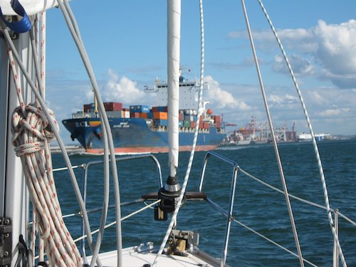
The main channel was packed with seriously large container ships and cruise liners, edging slowly through the darkness and probably terrified of running down a fisherman. We chose to stay well away, and went looking for somewhere to anchor.
The obvious places were along the edge of Moreton Island, but first we needed to pass over a dumping ground for unexploded military ordinance. After that we tried for Sholl Bank at Tangalooma, but the anchor bounced off impenetrable gravel. At least it gave us a chance to drop the mainsail. It was three o’clock in the morning and we were very, very tired.
We pored over the chart, and settled on a remote and fairly sheltered bay about eight miles away. We worked our way through the last of the shoals and into Moreton Bay proper, where we found ourselves bashing into enormous head-on swells. We were so tired now that we were motoring in thirty-minute shifts, grabbing alternate naps in the cockpit in between.
The first tinges of dawn touched the horizon ahead, and I simultaneously spotted the shore-based navigation light at Kounungai which marked our chosen anchorage. This piece of Moreton Island was supposed to be uninhabited, so what were all those extra white lights along the shore?
The dawn light grew stronger and I started to laugh out loud. They were the mast-head anchor lights of other boats! Obviously the holding was good. We dropped the pick in ten metres and, ignoring the bouncing swell, fell into a long, deep and exhausted sleep.
I just love that expression. It sounds like something out of an old pirate movie. In actual fact, with the tide turning at dawn, and wanting to wait for at least the third hour of flood before crossing the bar, what it really meant is that we had a leisurely breakfast, prepared the boat for sea, and were lifting anchor at about ten o’clock. But “leaving on the dawn tide” sounds so much more impressive.
We had no problems going out of the Gold Coast Seaway, apart from… “…are those people in the water?”. A quick check with the binoculars revealed that there were indeed a number of surfers swimming across the bar entrance, in amongst the continual trawler, fishing and yacht traffic. Crazy. But a passing police launch manoeuvred politely around one pair who were doggedly paddling down the main channel, so I suppose that this must be normal Surfers Paradise behaviour.
Despite our careful timing of the tide, there was still a bit of an incoming rip, presumably due to some kind of tidal overrun. Bronwyn kept the power on hard coming out of the bar (no smoke! A change of oil and cleaning the air filter seemed to have fixed that one) while I went down into the saloon to check on the location of the nearby shoaling reefs. Once out on the open sea, Bronwyn kept powering directly into incoming the swell, running up each wave and launching off the top to drop into the face of the next one. Down below, I was trying to stay on the chart table seat while juggling a pile of eIectronics and paperwork, and I had some idea of what it must be like to go over the Niagara Falls in a barrel.
I was feeling a bit battered when I emerged blinking into the sunlight, as we rounded the shoals and set off northward, heading for Moreton Bay and Brisbane. It was a beautiful day and we had a perfect light following wind. We experimented for a bit with flying the jib only, just to see what it was like, but quickly switched to the main and found ourselves running at six to eight knots. The only slight difficulty was a quartering swell which made steering quite an energetic task. When the swell approaches the boat on a diagonal, you have to corkscrew up and down each face as it passes under the boat. Still, we were fresh and rested and I enjoyed the exercise for a while before turning control over to the tireless Harriet.
Being used to the NSW forecasts which only try to predict swell heights to within the nearest metre or so and are often wildly inaccurate (eg “Swell: SE 1 to 2 metres” may well turn out to be more than 3), we were quite amused to see that the Queensland forecast was a bit more precise; apparently we could expect to be sailing in exactly 1.7 metres of swell.
There were very few marine hazards shown on the charts, so we just concentrated on sailing as straight a line as possible. The Eastern Australian Current did have one last go at us around one headland, but after that it seemed to give up. Cashing in on this bonus, we decided to head straight across one large bay instead of hugging the coast, because that would put the swell directly behind us and to tell the truth we were getting a bit tired of the constant pounding. As we got into deeper water, a combination of fair winds and following surf got us up to eight knots, and we had to revise our timetable. We had planned to sail through the night so that we would arrive at Moreton Bay in daylight to negotiate the shoals across the entrance, but it looked like we were going to arrive much earlier, in the middle of the night.
Keeping a lookout, I saw a squall racing towards us and shouted to Bronwyn, who was preparing a meal in the galley. She calmly asked me for a time check for her rice. Exactly seven minutes later we were triple-reefed and back on track, and Bronwyn went back down and took the rice off the stove just as the squall hit us with 35 knots and a flurry of rain. As soon as it had passed, dinner was served.
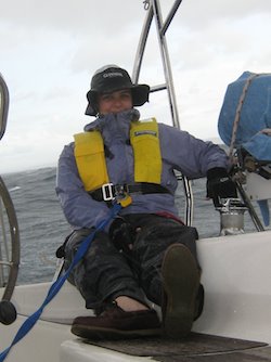
BRONWYN ON WATCH IN THE RAIN
The rain and the swell kept on harrying us but Pindimara was flying, and by late evening we were approaching the notorious Moreton Bay shoals in pitch darkness and zero visibility. One option would be to stand out to sea and wait for dawn, but we were feeling battered and bruised and just wanted to get out of the swell, so we hove to and got out the charts.